|
|
|
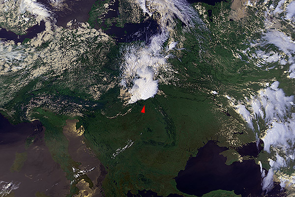
6 July 1988 1348 UTC NOAA 9 Northeast Slovakia, southeast Poland |
|
|
|
|
(Please go first to the ch3enh image to identify the position of the plume; I suggest this step to be taken also for the other cases that follow.) This case is interesting for two reasons. First: the plume in the visible/near IR band (ch1+2+4 and channel 2 images) has a very sharply defined "source" at the spike of the plume, which is not quite common (typically the "source" is rather slightly smudged); notice that the position of the "source" is exactly above a warm spot in the ch4enh image. Second: the plume in the ch3enh image seems to be "cut off" at some distance from the visible/near IR "spike". Since in the visible/near IR band the plume is well defined up to its source, this means that the plume generating mechanism must have changed shortly before the NOAA 9 overpass (the plume is still being generated, however its microphysical composition is different now). |