|
|
|
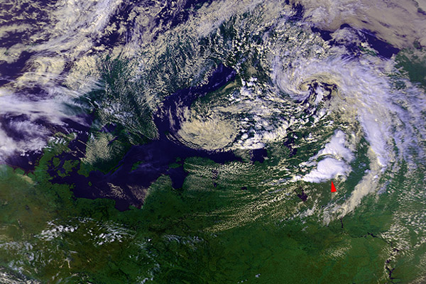
7 August 1992 1226 UTC NOAA 11 Northwest Russia (about 400 km south of Arhangelsk) |
|
|
|
|
A first example of a "plume-like" feature in the ch3enh image, apparently "springing" from the center of the large storm and carried to the east by upper level winds. Notice that its "source" is above (or within) a warmer embedded area at the ch4enh image. Besides this feature, several other areas of the increased 3.7 µm reflectivity can be found in the image - one of them at the southwest part of the same storm, the other ones above storms to the southwest of the big one. |