|
|
|
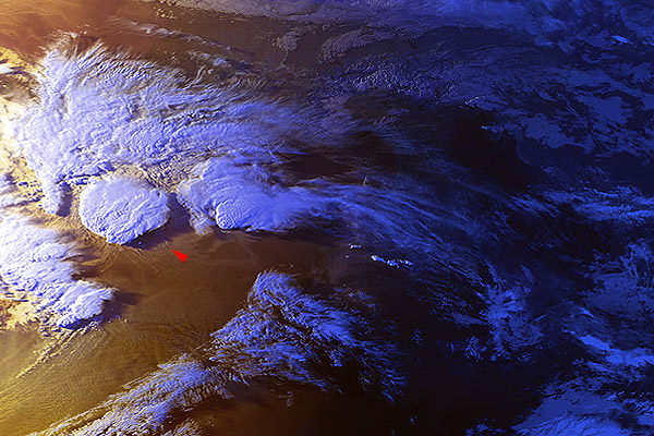
11 September 1996 1724 UTC NOAA 12 Spain, Balearic Islands (Ibiza) |
|
|
|
|
Another spectacular case - late afternoon (or early evening?) tornadic storm above Ibiza. It might be a bit difficult task for you to find some landmarks on the location image - it is close to sunset, thus the right half of the image is already in a shadow. Though not easy, it is possible to recognize Italy, Adriatic coast and Alps there... Anyhow, don't bother with that - you will find coastlines in the detailed images. In this case, the plume is distinct in the visible/near IR channels as well as in the 3.7 µm band. This plume, however, does not exhibit any significant increase of the 3.7 µm reflectivity - it is so clearly visible because of low angle illumination and shadows it casts. The ch3+4+D54 image is a composite of channels 3, 4 and difference between channels 5 and 4 (this difference shows mainly a low level moisture). Besides the co-location of the plume source and warm embedded area inside the "cold-U", notice in this composite image the well-defined clear, warm air inflow region at the southeast edge of the storm... If you wish, you can also click below to display the channels 1, 2 and 4 composite image in the original satellite projection - doesn't this look like a "3D" image to you? (The image will be displayed in a new browser window, so just close the window when done): |