|
|
|
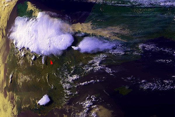
30 June 1998 1715 UTC NOAA 12 Northwest Spain |
|
|
|
|
A case illustrating that at least some of the increased 3.7 µm reflectivity can be associated with a very thin uppermost layer only. Focus at the storm marked by the red arrow in the ch1+2+4 image: notice the "finger-like" structures, distinctly casting shadows on the anvil top underneath, structure of which can be seen through these "fingers". From the ch3enh image it seems that the particles which compose the "fingers" are being generated close to the storm core and consequently are drifted away by upper level winds. Also notice the overall chaotic appearance of the cloud top reflectivity above the other storms in the area. (Don't get confused by slightly different shape of the storms in the location image and all the other ones: the first is shown in raw satellite projection, while the other ones in polar stereographic projection.) |