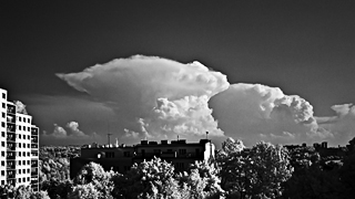
Ricoh GXR-A16, interval 2 seconds, speed 60x
20150425_0835-0900utc_Daliborka_1600x1080.mp4 (27 MB)
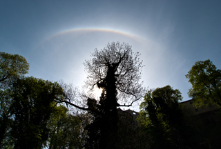
Solar ice halo above Prague Castle. Bright upper ice halo tangent arc, above a much dimmer 22° halo (see also this strongly enhanced image). Captured above Daliborka (one of the towers of Prague Castle) from Jelení příkop, Praha, Czech Republic. Processed from DNG files.

Ricoh GXR-A16, interval 5 seconds, speed 150x
20150429_0341-0428utc_Praha_1920x1080.mp4 (45 MB)
Sunrise above Praha. Only for several days each year (in spring and autumn) it is possible to capture this scenery, the Sun ascending up the sky in vicinity of Prague's Old Town towers. Captured from slopes of Petřín Hill, above Újezd, Praha, Czech Republic. Processed from DNG files.
Ricoh GXR-A16, interval 5 seconds, speed 150x
20150510_1225-1315utc_Mila_R0069215_1920x1080.mp4 (45 MB)
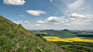
Wave clouds and shallow convection above České Středohoří (Böhmisches Mittelgebirge). Captured from hill Milá (510 m a.s.l.), Most district, western Bohemia, Czech Republic. Processed from DNG files.
Ricoh GXR-A16, interval 2 seconds, speed 60x
20150513_0750-0920utc_Radar-Brdy_1920x1080.mp4 (195 MB, 1920x1080, H.264 / MPEG-4)
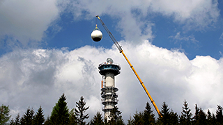
Radar BRDY. After 15 years of operations, CHMI replaced its old weather radar Brdy by a new one. The series in its first part captures lifting of the radar antenna and its mount, in the second part lifting of the radar dome, ultimately covering the radar itself.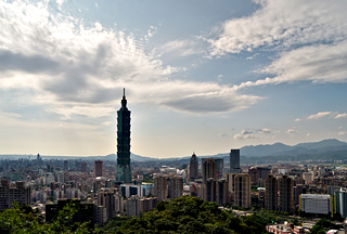
Ricoh GXR-A16, interval 5 seconds, speed 150x
20150528_0710-0815utc_Taipei_1600x1080.mp4 (59 MB)
Wave clouds above Taipei. The dominant building in this sequence is 508 m high Taipei 101, which definitely is worth a tour if you happen to visit the town. Probably the best view of this skyscraper and downtown of Taiwan's capital is from a nearby Elephant Mountain (Xiang Shan), with its steep trails and several viewpoints, from where this sequence was taken. Processed from DNG files.
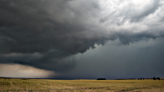
Ricoh GXR-A16, interval 2 seconds, speed 60x
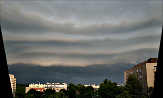
20150614_1836-1906utc_Praha-Kacerov_1800x1080.mp4 (66 MB)
Shelf cloud and turbulent cloud base of a weak convective storm. Captured from Kačerov, Prague, Czech Republic, southward view.
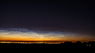
Ricoh GXR-A16, interval 5 seconds, speed 150x
20150710_1845-2130utc_NLC-Okrouhlik_1920x1080.mp4 (76 MB, processed and added here on 2017-12-18)
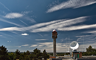
Ricoh GX100, interval 10 seconds, speed 300x, polarizing filter
20150722_1008-1200utc_Libus_1920x1080.mp4 (48 MB)

Ricoh GX100, interval 10 seconds, speed 300x, IR72 filter
20150809_1523-1737utc_Praha-Kacerov_IR72_1280x720.mp4 (45 MB, updated on 2018-01-29)
--------------------------
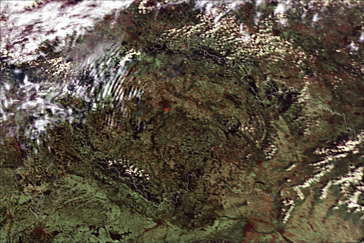
One of the important topics of recent satellite meteorology is an impact of satellite scan period and geometrical resolution (pixel size) on representativness of the acquired image data - e.g. how much of storm top evolution we miss with longer scan intervals and lower resolution (larger pixels). The most recent (or upcoming) geostationary weather satellites are capable of operating at short scan intervals, called rapid scan service, ranging typically from 1 to 5 minutes, and with higher spatial resolution - reaching 0.5 km. The simulated loops in the table below give us a hint of how much these parameters (scan period and pixel size) can affect the informative value of the image sequence. In this case, the simulations do not represent real satellite view, but sideways, ground view of the storms from above; the lower-resolution loops were calculated based on distance of these storms and view angle of the camera. See also this image composite of ground photo with radar data.
| 15:25 - 16:25 UTC |
10 sec |
1 min |
2.5 min |
5 min |
10 min |
| 50 m |

|
|
|
|
|
| 0.5 km |
|
|
|
|
|
| 1.0 km |
|
|
|
|
|
Ricoh GXR-A16, interval 5 seconds, speed 125x
20150816_1353-1411utc_Mandava_1280x720.mp4 (18 MB)
Ricoh GXR-A16, interval 5 seconds, speed 150x
20151101_0740-0900utc_Vltava_vyhlidka-Maj_1640x1080.mp4 (74 MB, processed and added here on 13 Feb 2017)